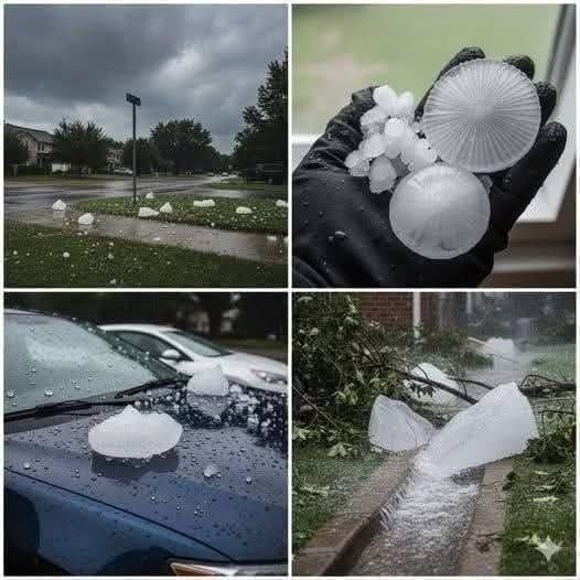
On the afternoon of June 28, 2012, residents of Hinckley and Burbage in Leicestershire, England, experienced a weather event they would remember for years. What began as an ordinary summer day quickly became an extraordinary storm, as enormous hailstones fell from darkening skies and struck cars, houses, shops, and streets.
Within minutes, windscreens were cracked, conservatory roofs were damaged, trees lost their leaves, and parts of the town centre experienced flooding. For many residents, the sudden change was difficult to comprehend. Vehicles that had been parked outside only moments earlier were left covered in dents, while homes and businesses faced unexpected repair bills.
The storm became one of the most memorable severe-weather events in the region’s recent history. Beyond the damaged property and financial losses, it demonstrated how quickly powerful atmospheric conditions can transform a familiar community.
How the Severe Hailstorm Developed
The conditions that led to the June 28 storm had been developing over several hours. According to a detailed account published by local weather observer Dean Whittaker in 2013, warm and unstable air moving north from the Iberian Peninsula met cooler air arriving from the Atlantic.
This contrast between air masses helped create an atmosphere favourable for powerful thunderstorms. Wind shear, which refers to changes in wind speed or direction at different heights, also contributed to the development of rotating storm structures.
One particularly important type of storm is known as a supercell. Unlike an ordinary thunderstorm, a supercell contains a persistent rotating updraft called a mesocyclone. This internal rotation can help the storm maintain its strength and produce severe weather, including large hail, intense rainfall, and damaging winds.
The storm system affecting Leicestershire was part of a wider period of unsettled weather across the United Kingdom. The Met Office later documented the severe thunderstorms of June 28, noting that they brought torrential rain, damaging hail, and more than 50,000 lightning strikes across the country during the day.
When the Hailstones Began to Fall

As midday approached, the skies over Hinckley became increasingly dark. Thunder could be heard, and heavy rain began moving across the area.
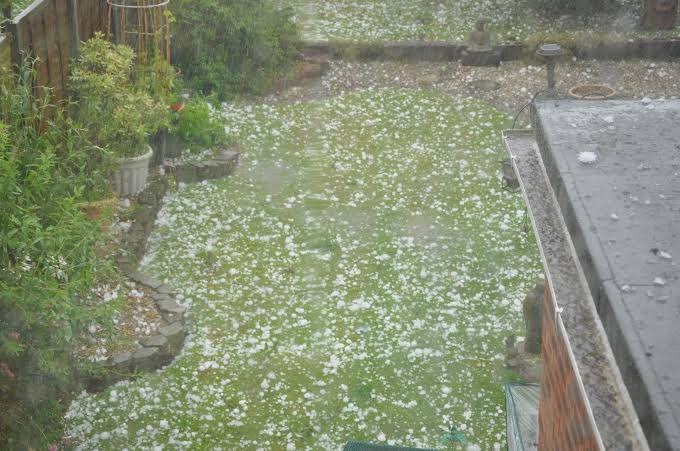
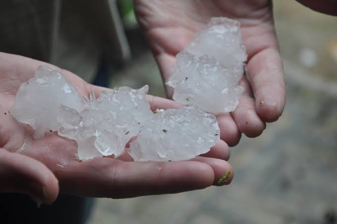
At approximately 12:57 p.m., according to the local weather account, large hailstones started falling over Hinckley and nearby Burbage. Some were reportedly larger than golf balls, while several unusually large specimens were estimated to measure between 90 and 100 millimetres.
The hail was not simply a brief shower of small ice pellets. Large stones struck hard surfaces with considerable force, damaging vehicles and buildings across the affected neighbourhoods.
Cars parked outdoors were particularly vulnerable. Their roofs, bonnets, and body panels developed deep dents, while windscreens and side windows were cracked or shattered. Some vehicles sustained so much damage that repairing them was considered uneconomical.
Homes also suffered. Roof tiles were damaged, conservatory panels were penetrated, and garden structures were affected. Trees lost leaves and branches, adding further debris to roads and drainage systems.
The most remarkable aspect was how quickly everything happened. The local account described the most intense phase as lasting only around ten minutes. Yet that short period was enough to leave widespread damage across the area.
Why Were the Hailstones So Large?
Hail forms inside strong thunderstorm clouds when water droplets are carried into areas of freezing temperatures. These droplets freeze and may collect additional layers of ice as they move through the cloud.
In powerful thunderstorms, strong rising air currents can keep hailstones suspended within the cloud for longer periods. As they encounter more supercooled water droplets, they can grow larger before gravity eventually pulls them toward the ground.
The strength of these updrafts is one of the factors that influences hailstone size. When atmospheric conditions support powerful vertical air movement, hail can become considerably larger than the small pellets commonly associated with ordinary thunderstorms.
The June 2012 event demonstrated how unusual atmospheric conditions can produce hail capable of damaging vehicles, roofs, windows, and outdoor structures.
However, the reported measurements should be understood as local observations rather than a complete official measurement record of every hailstone that fell.
Thousands of Vehicles Were Reportedly Damaged
Among the most visible consequences of the storm was the damage to parked vehicles.
Local accounts estimated that approximately 5,000 cars in the affected area were damaged. Many had dents across their roofs and bodywork, while others suffered broken or cracked windows.
The scale of the damage created an immediate challenge for vehicle owners and repair businesses. Drivers had to contact insurers, arrange inspections, and find available repair services. Workshops faced a sudden increase in demand, while some vehicles were considered beyond economical repair.
The local weather report also described the experiences of two garages in the area. At Wynne’s Garage, owner Wynne Richards reportedly said that every car parked outside had sustained damage severe enough to make repair uneconomical. Boyslade Garage was also reported to have lost between 50 and 60 vehicles.
These accounts illustrate how the storm affected more than individual households. Businesses that depended on vehicles, outdoor stock, and customer access also faced substantial disruption.
A separate report published by Insurance Times on June 29, 2012, confirmed that the AA had already received claims for cars damaged by the hailstorm. The insurer also reported assisting vehicles affected by floodwater in the Midlands.
Flash Flooding Added to the Damage
The hailstones were not the only problem.
As large quantities of ice, leaves, and broken branches accumulated on roads and around drainage systems, water struggled to flow away. Heavy rainfall added to the pressure, causing surface water to collect in parts of the town.
Some streets experienced flooding, and shops in the town centre were reportedly affected. Properties with damaged roofs or conservatories faced an additional challenge as rainwater entered areas already exposed by the storm.
This combination of hail and intense rainfall made the event especially disruptive. Even after the largest hailstones stopped falling, residents still had to deal with blocked drains, standing water, fallen branches, and damaged property.
The wider weather conditions across the country were also serious. In a statement to Parliament on July 3, 2012, the government reported that thunderstorms on June 28 had caused significant flooding in several parts of England, with at least 570 properties confirmed as flooded at that stage.
The statement placed the Hinckley storm within a much broader period of severe weather that affected communities across the Midlands and other regions.
The Financial Impact on Homes and Businesses
The financial consequences extended well beyond the cost of replacing broken windows or repairing damaged cars.
For households, the storm meant dealing with vehicle repairs, roof inspections, replacement conservatory panels, and damaged possessions. Some families also had to arrange temporary repairs to protect their homes from further rainfall.
Businesses faced different pressures. Garages had to assess damaged vehicle stock, while shops and other commercial properties dealt with repairs and interruptions to normal operations.
A local weather report estimated that the storms affecting Leicestershire on June 28 caused as much as £150 million in damage to vehicles, properties, and businesses. This figure should be treated as a historical estimate rather than a confirmed final insurance total.
Nevertheless, contemporary reports and local observations make clear that the storm created substantial losses across the region. The damage to thousands of vehicles alone placed considerable pressure on owners, insurers, and repair services.
How the Community Responded
After the storm passed, residents began leaving their homes and workplaces to assess what had happened.
Car parks and residential streets revealed the extent of the damage. People photographed unusually large hailstones, checked on relatives and neighbours, and contacted insurers to report losses.
Local weather enthusiasts also began collecting photographs, videos, and observations. These records later helped document the event in greater detail.
The 2013 account by Dean Whittaker brought together information from witnesses and contributors, including photographs of hailstones, damaged properties, and the approaching storm. It provided a valuable local record of an event that had unfolded too quickly for many people to fully understand at the time.
Such community records are important in documenting severe weather. Official weather observations explain the wider atmospheric conditions, while photographs and personal accounts help show how those conditions affected everyday life.
What the 2012 Hailstorm Reminds Us About Severe Weather
The Hinckley and Burbage hailstorm remains a striking example of how quickly a summer thunderstorm can become destructive.
Although hail is a familiar weather phenomenon, exceptionally large hailstones are much less common. When they occur alongside strong winds and intense rainfall, the consequences can extend across entire neighbourhoods.
Events like this also highlight the importance of practical preparation. During severe thunderstorm warnings, moving vehicles into covered parking where possible, staying away from windows, and avoiding unnecessary travel can reduce exposure to some of the risks.
Residents should also avoid approaching damaged electrical equipment, unstable structures, or floodwater after a storm. Even when the sky begins to clear, hazards may remain.
For communities, preparation and communication can make a meaningful difference. Local weather alerts, reliable emergency information, and cooperation between residents and public services all contribute to a safer response.
A Summer Afternoon That Became Part of Local History
The storm of June 28, 2012, lasted only a short time in Hinckley and Burbage, but its consequences remained long after the clouds had passed.
Thousands of vehicles were reportedly damaged, homes and businesses required repairs, and parts of the local community faced an unexpected financial burden. The event also left behind photographs, videos, and personal memories that continue to document its extraordinary intensity.
For those who experienced it, the day was a reminder that familiar surroundings can change dramatically in a matter of minutes. It also showed the value of local cooperation and shared information when communities face unexpected challenges.
The 2012 Hinckley hailstorm was more than an unusual weather event. It became a lasting reminder of nature’s power and the resilience people can show when ordinary life is suddenly disrupted.
Sources
-
Met Office, Record Rainfall: April to July 2012.
-
Dean Whittaker, Leicestershire Tornadic Supercell Storms of 28th June 2012, Hinckley Weather Blog.
-
Insurance Times, AA Insurance Reports 29 Claims from Leicester Hail Storm, June 29, 2012.
-
UK Parliament, Flooding Statement, July 3, 2012.