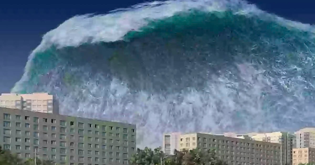
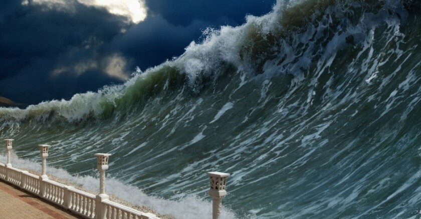
A groundbreaking study has raised renewed concerns about the long-term seismic and tsunami threats facing several major regions in the United States. According to research published in the Proceedings of the National Academy of Sciences (PNAS) and conducted by Virginia Tech scientists, an 8.0-magnitude earthquake could strike the Cascadia Subduction Zone, a tectonic boundary off the Pacific Northwest coast, potentially generating waves as high as 1,000 feet and causing extensive flooding.
The implications of such an event could be catastrophic—endangering communities in California, Oregon, Washington, Alaska, and Hawaii, among others. As the risk of climate-driven sea level rise compounds these natural hazards, scientists are calling for proactive planning to minimize long-term damage.
What Is the Cascadia Subduction Zone?
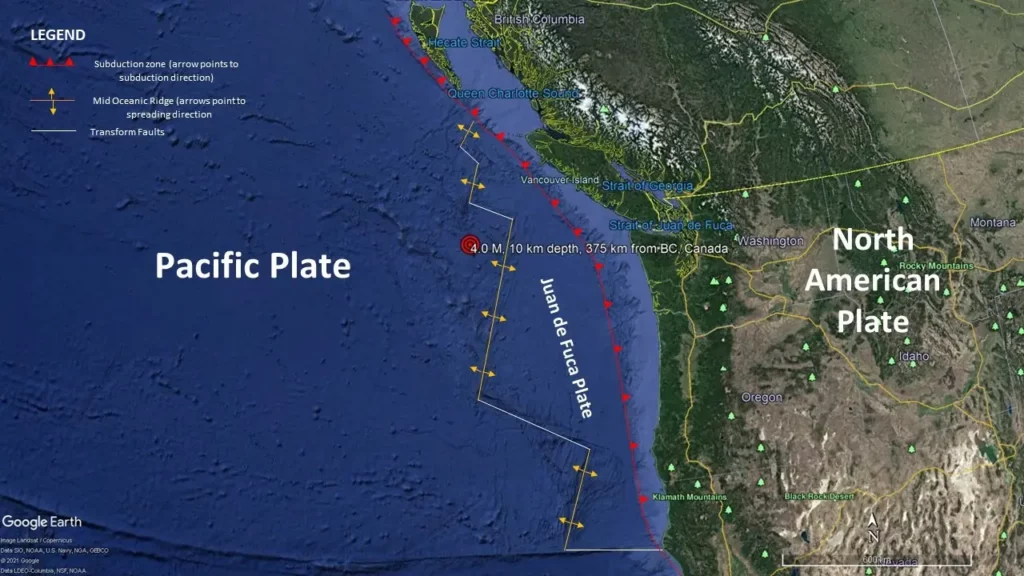
The Cascadia Subduction Zone (CSZ) is a 600-mile-long fault where the Juan de Fuca Plate is sliding beneath the North American Plate. This fault extends from Northern California through Oregon, Washington, and into Southern British Columbia.
This region is geologically similar to areas like Indonesia and Japan, where massive earthquakes and tsunamis are more common. Scientists have long warned that the CSZ is capable of producing megathrust earthquakes—the most powerful class of seismic events on Earth.
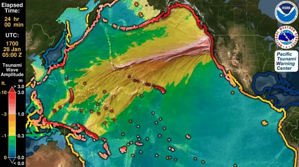
The last known massive earthquake along the CSZ occurred in January 1700, triggering a tsunami that reached Japan hours later. Geological records—including “ghost forests” of dead trees along the Pacific coast—stand as evidence of that natural disaster.
Study Highlights: Land Loss and Tsunami Floodplain Expansion
According to the Virginia Tech research team led by Dr. Tina Dura, an assistant professor in the Department of Geosciences, the effects of a Cascadia earthquake would not be limited to shaking. The quake could also cause parts of the coast to sink by up to 6.5 feet, expanding floodplains and altering coastlines significantly.
“The expansion of the coastal floodplain following a Cascadia Subduction Zone earthquake has not been previously quantified,” said Dr. Dura. “The impacts to land use could significantly increase the timeline to recovery.”
Their simulations show that if such an earthquake occurred today:
-
Over 14,000 residents would be exposed to post-quake flooding.
-
Around 22,500 structures could fall within the floodplain.
-
More than 770 miles of roadway could be damaged or submerged.
The data emphasizes that land subsidence, when combined with sea-level rise and tsunami inundation, could render large coastal areas uninhabitable or severely damaged for years.
At-Risk Regions: West Coast, Alaska, and Hawaii
The U.S. West Coast, particularly low-lying areas in Oregon and Washington, faces the most direct threat from a Cascadia earthquake and resulting tsunami. However, the risk is not confined to the continental U.S.
1. Alaska
Alaska lies within another active seismic zone and has previously experienced one of the largest earthquakes in recorded history—the 1964 Great Alaska Earthquake, which registered a magnitude of 9.2. That event caused tsunamis that killed more than 130 people and led to widespread destruction.
2. Hawaii
Due to its location in the Pacific Ocean, Hawaii is vulnerable to tsunamis generated by distant earthquakes. A Cascadia-generated wave could reach the Hawaiian islands within hours, depending on the quake’s magnitude and underwater landslides.
3. California
Although Southern California lies at the southern edge of the CSZ, a high-magnitude event could still generate tsunamis capable of reaching its shores. Coastal cities such as Crescent City and Eureka are already identified as high-risk zones.
The Role of Sea-Level Rise
The risks posed by tectonic activity are being amplified by climate change, particularly rising sea levels.
According to the study, sea levels are projected to rise by at least three feet by the year 2100. Combined with subsidence from an earthquake and the surge of a tsunami, this could dramatically expand the area of coastal inundation.
The research warns that communities may not only face immediate destruction from flooding but could also lose usable land permanently if recovery efforts are not properly planned.
Preparing for the “Compound Hazard”
The researchers call this threat a “compound hazard”—a dangerous convergence of seismic activity, tsunami waves, and long-term environmental shifts.
Key takeaways from the study include:
-
Local and federal agencies must update zoning laws and building codes to reflect new floodplain projections.
-
Emergency preparedness plans must consider not just earthquake response but also evacuation logistics for flooding and long-term resettlement.
-
Critical infrastructure such as power plants, hospitals, and transportation hubs in the floodplain should be relocated or reinforced.
“Preparing for these compound hazards can minimize long-term damage, ensure resilient communities, and protect critical coastal ecosystems from permanent degradation,” the study states.
Historical Context: The 1700 Tsunami
The most recent megathrust earthquake in the Cascadia Subduction Zone occurred on January 26, 1700. The event is estimated to have been between magnitude 8.7 and 9.2, based on geological and historical evidence.
Although there were no written records in North America, oral histories from Indigenous tribes and Japanese records of a mysterious “orphan tsunami” confirm the impact. The resulting tsunami struck the Pacific Northwest and traveled across the ocean to Japan, causing damage there more t
han 4,000 miles away.
Remnants of the disaster are visible today. In places like Washington and Oregon, ghost forests—stands of dead trees killed by saltwater intrusion—still mark the areas that sank during the quake.
Government and Scientific Response
Federal and state agencies, including the United States Geological Survey (USGS) and the National Oceanic and Atmospheric Administration (NOAA), are actively working to update hazard maps, improve tsunami warning systems, and provide public education materials.
Some of the initiatives include:
-
ShakeAlert Earthquake Early Warning System: Now operational in California, Oregon, and Washington.
-
Tsunami evacuation maps and signage campaigns in coastal communities.
-
Drills and simulations for schools and emergency services.
However, funding and implementation vary widely across different regions. Experts urge sustained investment to avoid future catastrophe.
What Should Residents Do?
If you live in or near a tsunami zone in the U.S., here are expert-recommended steps:
-
Know your evacuation zone and routes in advance.
-
Build an emergency kit with food, water, medication, and supplies for at least 72 hours.
-
Secure important documents in waterproof containers or cloud backups.
-
Sign up for local alerts and familiarize yourself with the ShakeAlert system.
-
Participate in community preparedness drills and support local mitigation efforts.
Conclusion
While the next Cascadia megathrust earthquake may not strike tomorrow, scientists agree that the risk is real and rising. When combined with rising sea levels and urban development along coasts, the need for preparation becomes urgent.
Planning ahead, understanding the science, and implementing policy changes today can reduce loss of life and property tomorrow. The next 50 years could test the resilience of coastal communities—but informed action can shape a safer future.