
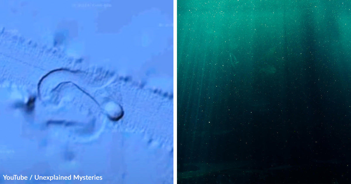
Viral stories about deep-sea missions often describe dramatic discoveries—mysterious objects, unexplained signals, or unknown structures resting thousands of meters below the ocean surface. While these narratives can be compelling, it is essential to separate verified scientific understanding from speculation.
How Deep-Sea Exploration Actually Works
Exploration of extreme ocean depths is conducted using advanced technology, including remotely operated vehicles (ROVs) and autonomous underwater vehicles (AUVs). Organizations such as National Oceanic and Atmospheric Administration and Woods Hole Oceanographic Institution regularly deploy these systems.
These vehicles are designed to:
- Map the seafloor using sonar imaging
- Collect geological and biological samples
- Record environmental data such as temperature and pressure
At depths of around 5,000 meters, conditions include near-freezing temperatures, complete darkness, and extremely high pressure. These factors make exploration challenging and require specialized equipment.
The Ocean Floor Remains Largely Unmapped
Scientific estimates indicate that a significant portion of the global ocean floor has not yet been mapped in high resolution. According to international ocean mapping initiatives, less than a quarter of the seabed has been fully studied with modern technology.
This means that new or unusual formations are regularly discovered, but they are typically explained through known geological processes after careful analysis.
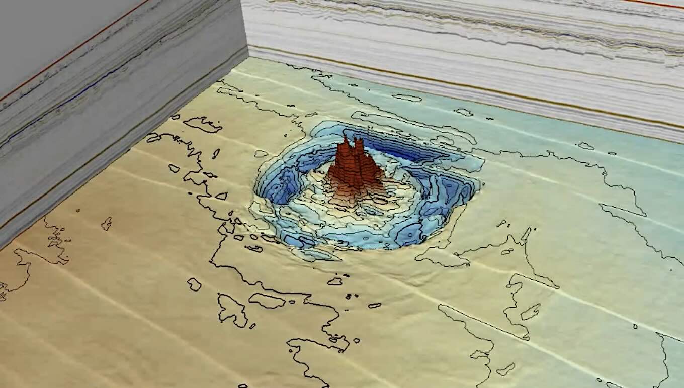
Understanding Seafloor “Structures”
Natural geological formations can sometimes appear artificial. Examples include:
- Basalt columns formed by volcanic activity
- Mineral deposits such as manganese nodules
- Fractured rock patterns that create geometric shapes
These formations may display symmetry or straight edges, which can be mistaken for man-made objects when first observed through limited imaging.
Scientists rely on multiple methods—such as sonar mapping, sample collection, and laboratory analysis—to determine the origin of such features.
Interpreting Sensor Data in Deep-Sea Missions
Deep-sea exploration equipment uses a variety of sensors, including:
- Sonar for mapping
- Cameras for imaging
- Electromagnetic detectors for environmental readings
However, sensor data can sometimes produce ambiguous or unusual results due to:
- Mineral composition of the seabed
- Interference from surrounding المياه
- Limitations in resolution at extreme depths
For this reason, initial observations are always treated as preliminary findings, not definitive conclusions.
Electromagnetic Readings: What Science Says
Claims of unusual electromagnetic signals in deep-sea environments require careful interpretation. In reality, certain طبيعي features can produce detectable signals, including:
- Metallic mineral deposits
- الطبيعي magnetic variations in Earth’s crust
- Hydrothermal vent activity
These are well-documented phenomena studied in fields like marine geology and geophysics. Without confirmed data from multiple sources, such readings cannot be considered evidence of unknown technology or artificial structures.

Marine Life at Extreme Depths
Although conditions at 5,000 meters are harsh, life does exist in deep-sea environments. Scientists have documented:
- Bioluminescent organisms
- Deep-sea fish and invertebrates
- Microbial ecosystems near hydrothermal vents
Organizations like Schmidt Ocean Institute continue to discover new species in these regions.
Unidentified movement or shadows captured by cameras are often explained by:
- Marine organisms خارج previously documented observations
- Sediment disturbances
- Camera or lighting limitations
Why “Mysterious Objects” Often Have Natural Explanations
History shows that many deep-sea “mysteries” are eventually explained through scientific investigation. Initial interpretations can be influenced by:
- Limited visibility
- Incomplete data
- Human tendency to recognize patterns
For example, formations that appear artificial in early images are frequently identified later as natural الصخور structures after detailed study.
The Role of Scientific Verification
Before any discovery is confirmed, scientists follow a rigorous process:
- Re-examining sensor data
- Conducting repeat observations
- Comparing findings with existingبحاث
- Publishing results for peer review
This process ensures that conclusions are based on evidence rather than assumption.
The Importance of Avoiding Speculation
Viral content often includes elements such as:
- “Unexplained objects”
- “Hidden technology”
- “Classified discoveries”
However, without confirmation from credible sources, these claims remain speculative.
Reliable information about ocean exploration typically comes from:
- Government scientific agencies
- Academic research institutions
- Peer-reviewed journals
These sources prioritize accuracy and transparency.

Why the Ocean Continues to Fascinate Scientists
The deep ocean remains one of the least explored environments on Earth. Its أهمية lies in:
- Understanding Earth’s geology
- Discovering new species
- Studying climate systems
Ongoing exploration projects aim to map and study these regions in greater detail, contributing to global scientific knowledge.
Conclusion
There is no verified evidence supporting claims of a mysterious artificial object discovered at 5,000 meters that cannot be explained by current science. While unusual formations and sensor readings can occur, they are typically investigated and understood through established geological and oceanographic methods.
Deep-sea exploration continues to reveal new information about our planet, but scientific progress depends on evidence, verification, and careful analysis. By relying on credible sources and avoiding speculation, readers can better understand the fascinating realities of the ocean floor without being misled by exaggerated narratives.